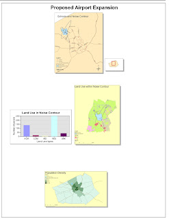
My experience with ArcMap has been a very positive one. The computer program is extremely complicated and complex and with this lab I only felt like I just scratched the surface of what this powerful program can do. ArcMap is a very well thought out program with few pitfalls. I would say that its extreme complexity is a pitfall being that it can take years to master, thus being discouraging for small, simple users. If I had to pinpoint one area in which I had difficulty in with this lab, it would be saving the program on the computer lab computers. Regarding the program, creating the graph was the most difficult part for me because I lost the data at first and had to redo that part. It has, however, showed me that you have to be extremely organized in how you work and operate ArcMap so that nothing gets lost in your program. Also, drawing the road was no easy task since you have to be accurate and precise. However, ArcMap is very useful with creating new streets and has several features that help the user accurately and efficiently add streets and other features to the map.
GIS has extreme potential for all sorts of users. GIS can be opened up for a variety of uses, from general education to urban planning to environmental research. Also, with the great programs like ArcMap, a user can become familiar with creating maps after working with it for only a few hours. ArcMap lets professionals and amateurs alike work with the power of GIS to get informed about communities and the world and manipulate maps and data with incredible power. As an amateurs, I greatly enjoyed using ArcMap and am excited to see its further powers and abilities and how it can enrich both my academic and professional life.
GIS also has a few pitfalls associated with it. First off, too much reliance on GIS can abstract from other real world phenomenon. While GIS does a great job of aggregating data, displaying it in a user friendly fashion, and help the user draw a conclusion, too much reliance on a map and not on human behavior and the nature in which it acts and changes can be devastating to research. Humans are more than what you just see on paper, so while you may see a noise contour affecting a neighborhood and automatically guess that it will bring down home prices in the region, further surveying data is needed to draw a solid conclusion. Researchers need to rely on other techniques besides just looking at data from a map like using economic valuations like contingent valuation or hedonic real estate valuation to see how prices of homes would actually react to an airport nearby. Like anything in life, if you look at it from one-dimension, you can lose the complexity, elegance, and reality of a situation and a user of GIS must be weary of that and take a holistic approach to research.
Also, there is more to GIS than just a map; and there is more to a map than just a few points of interest. The design plays a crucial part in the creation of a map. The design of a map deals with the scale of the map, points of interest, points of focus, projections, and aesthetics like neat-lines, shadows, where to place the legend and north arrow, among other features. Without a clean and thoughtful design, not only is it less professional but less people will be interested in what it has to say and the more confusing it will be for the viewer.
No comments:
Post a Comment